Geographic Information Systems (GIS) is the combination of software, computers, and data that allow one to analyze and display information that has been located on the face of the earth.
The power of GIS is in the information associated with a given location. Some say that location, location, location is what’s important, while others say that information is knowledge, and knowledge is power. GIS combines these two trains of thought to show where desired features are located, while symbolically or descriptively conveying information about the feature.
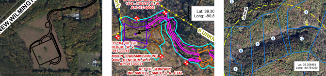
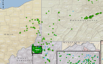
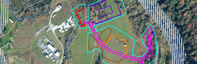
Navitus Engineering is on the forefront of GIS technology and provides a range of GIS services to the client including Mapping, Data Attribute Analysis, and Geo-Database Design.